Topic outline
-
Aula 9
Inventário Florestal com LiDAR – escaneamento aeroembarcado
-
Dinâmica
A Fazenda A foi sobrevoada com LiDAR em 2013. Pontos LiDAR dentro dos limites das parcelas de inventário medidas naquele ano foram usados para gerar métricas LiDAR. A figura abaixo ilustra os pontos LiDAR observados em uma das parcelas medidas no Talhão 101.
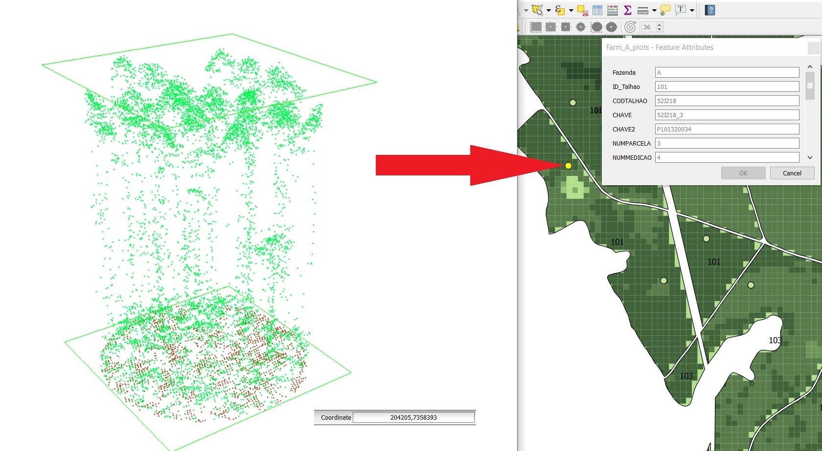
Vários modelos, tendo as métricas LiDAR como variáveis preditivas dos parâmetros florestais medidos pela equipe de inventário, foram testados. Para estimar volume, por exemplo, foi ajustado o seguinte modelo: VOL = 0.2694 P90 1.8385 Idade 0.6014 . A disponibilidade de dados LiDAR para toda a fazenda, e o uso desse modelo preditivo, permitiu a elaboração de um preciso mapa de volume para toda a fazenda (clique AQUI para uma versão PDF desse mapa).
Para aferir o potencial do LiDAR como ferramenta de inventário e monitoramento florestal, use o visualizador de dados potree para explorar algumas das parcelas medidas no inventário de 2013 na Fazenda A. Escolham uma das tarefas e em grupo estudem o uso do visualizador para executar as respectivas tarefas envolvendo as parcelas de inventário atribuídas a cada tarefa: meça algumas alturas das árvores nas parcelas, e compare essas alturas com o valor informado pela equipe de inventário para a respectiva variável MHDOM (vide tabela no final desta seção). Importante: use projeção ortográfica para obter as medidas.
Tarefa 1
Parcelas do
Talhão 101Tarefa 2
Parcelas do
Talhão 106Tarefa 3
Parcelas do
Talhão 107Fazenda
ID_Talhao
Parcela
ANOREF
DATAREALIZADA
LAT_UTM23S
LONG_UTM23S
MHDOM
VOL
AB
A
101
P101320014
2013
8/30/2013
204541.0853
7357992.459
31.40
328.17
27.45
A
101
P101320034
2013
8/30/2013
204206.5662
7358395.764
30.93
373.92
30.19
A
106
P106410014
2013
4/18/2013
205801.7903
7357663.512
26.25
276.13
26.03
A
106
P106410054
2013
4/18/2013
206115.0093
7358301.768
27.30
302.30
27.95
A
107
P107410032
2013
10/18/2013
206590.7844
7358137.193
13.80
36.64
8.02
A
107
P107410052
2013
10/18/2013
206745.7844
7358616.194
15.60
59.77
11.13